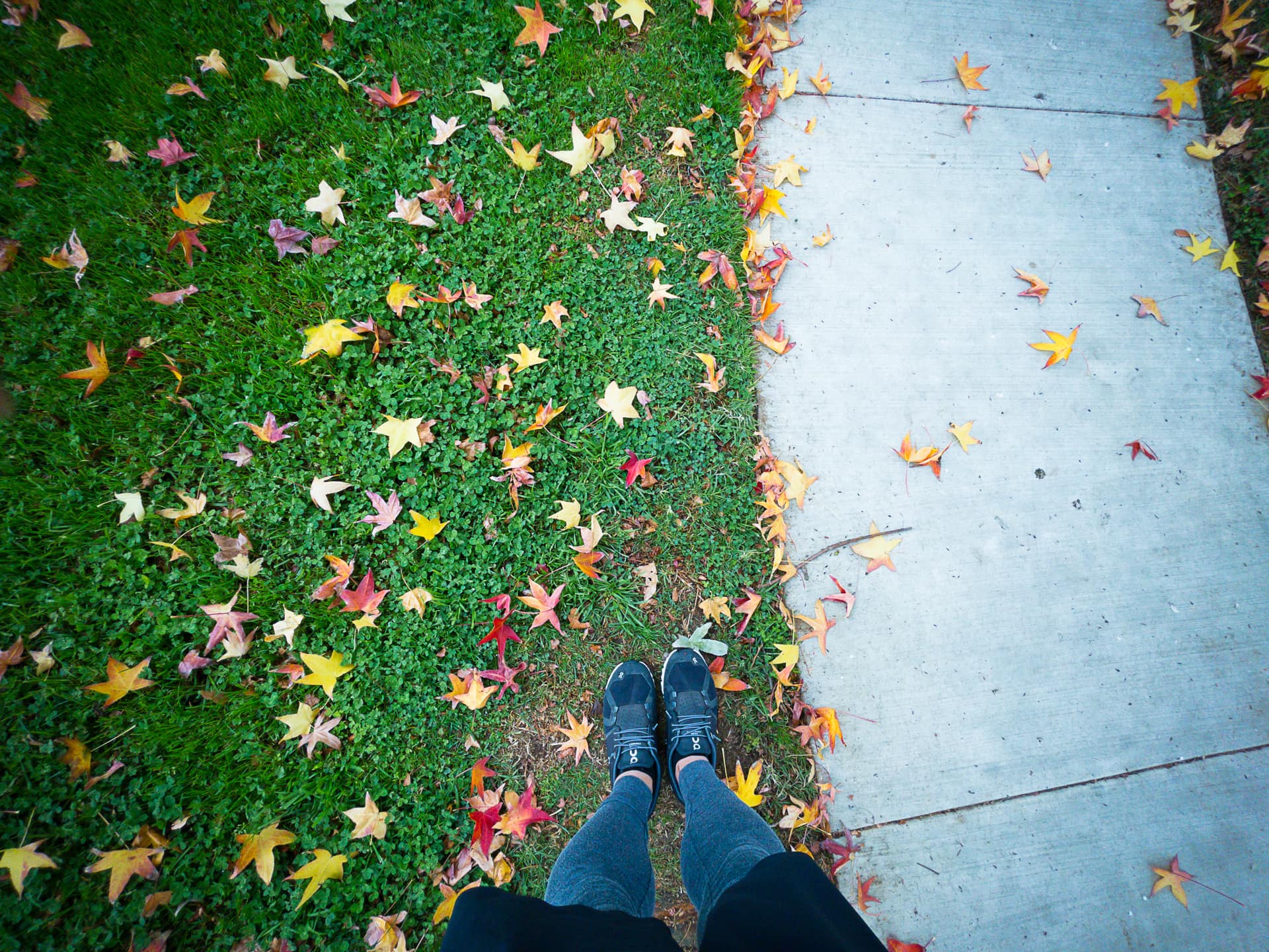
I’ve been trying to keep to my running schedule while we are on holiday in SoCal, but it’s been difficult. The main reason is that Torrance is so crowded with people that it’s a hassle to run on the sidewalks and streets in a socially distanced way. In order to avoid others, I am constantly having to switch to the other side of the road or sidewalk, or hop from the sidewalk to the road or vice-versa.
At my neighborhood in Texas, the roads are very wide so I can pretty much run there and avoid most contact with others. It makes for a relaxing run. But in Torrance, constantly having to keep an eye on my surroundings gets old real quick… and it makes for a mentally exhausting hour. Still, I am getting a few miles in on my run days, which is better than nothing.
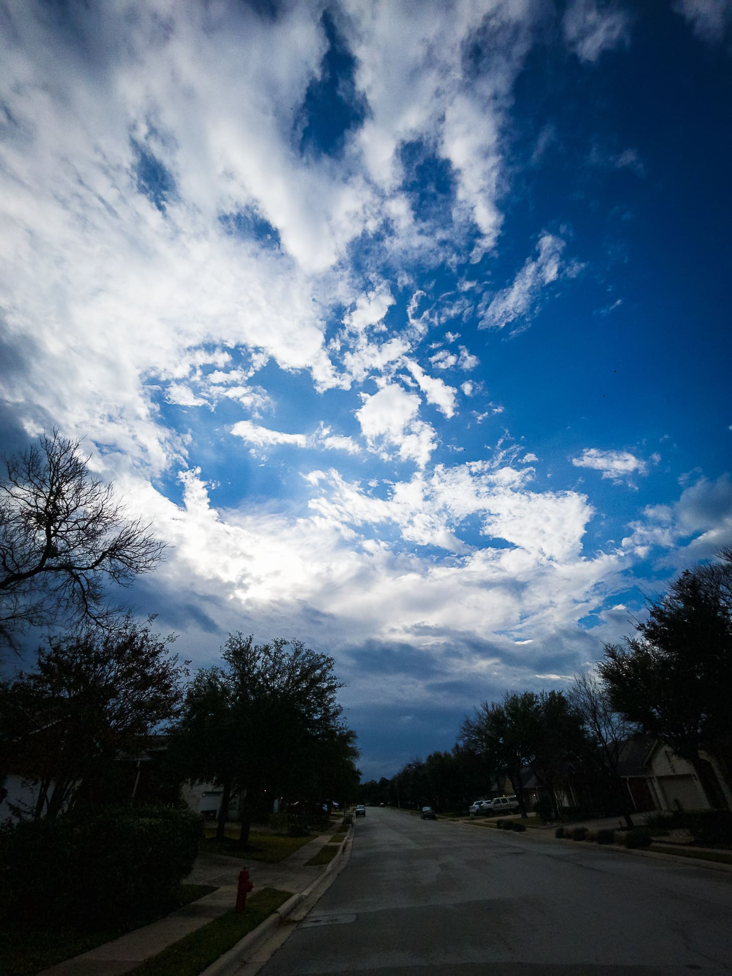
I learned a couple of good lessons this morning. When going out for a run, don’t just check the current temperature when you begin the run, but also look at what the temperature will be during the run. Also, check what the wind is like.
Today, I saw it was 68°F. Great, I thought. I can wear my regular running outfit, and it will be perfect when the sun warms up into the 70s. But unbeknownst to me, a cold front was just arriving, and the freezing winds were blowing during my run and the temperature dropped down into the 50s! I was seriously suffering when running into that wind. So much so that I had to cut my run short by 2 miles.
I’m glad I did though because my arms were frozen. I had to jump into the hot shower and thaw out! As disappointing as today’s run was, it was a valuable learning experience. Next time I’ll be better prepared for sure.
I’m also glad that I got a nice photo as the sun broke through the clouds. 😊
Photo info: Apple iPhone 12 mini, 1.55mm, f/2.4, 1/3200 sec, ISO25 “Clouds” Cedar Park, 2021
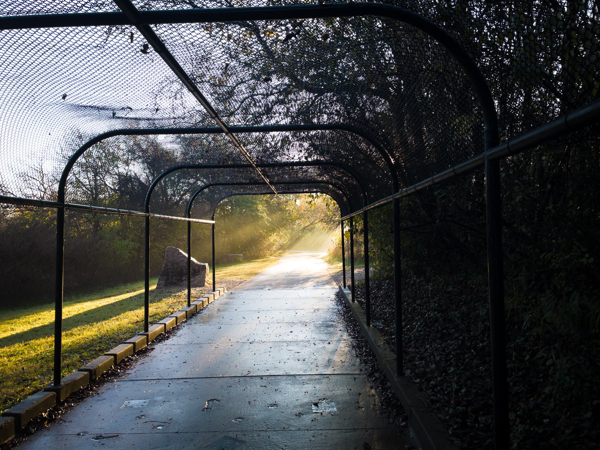
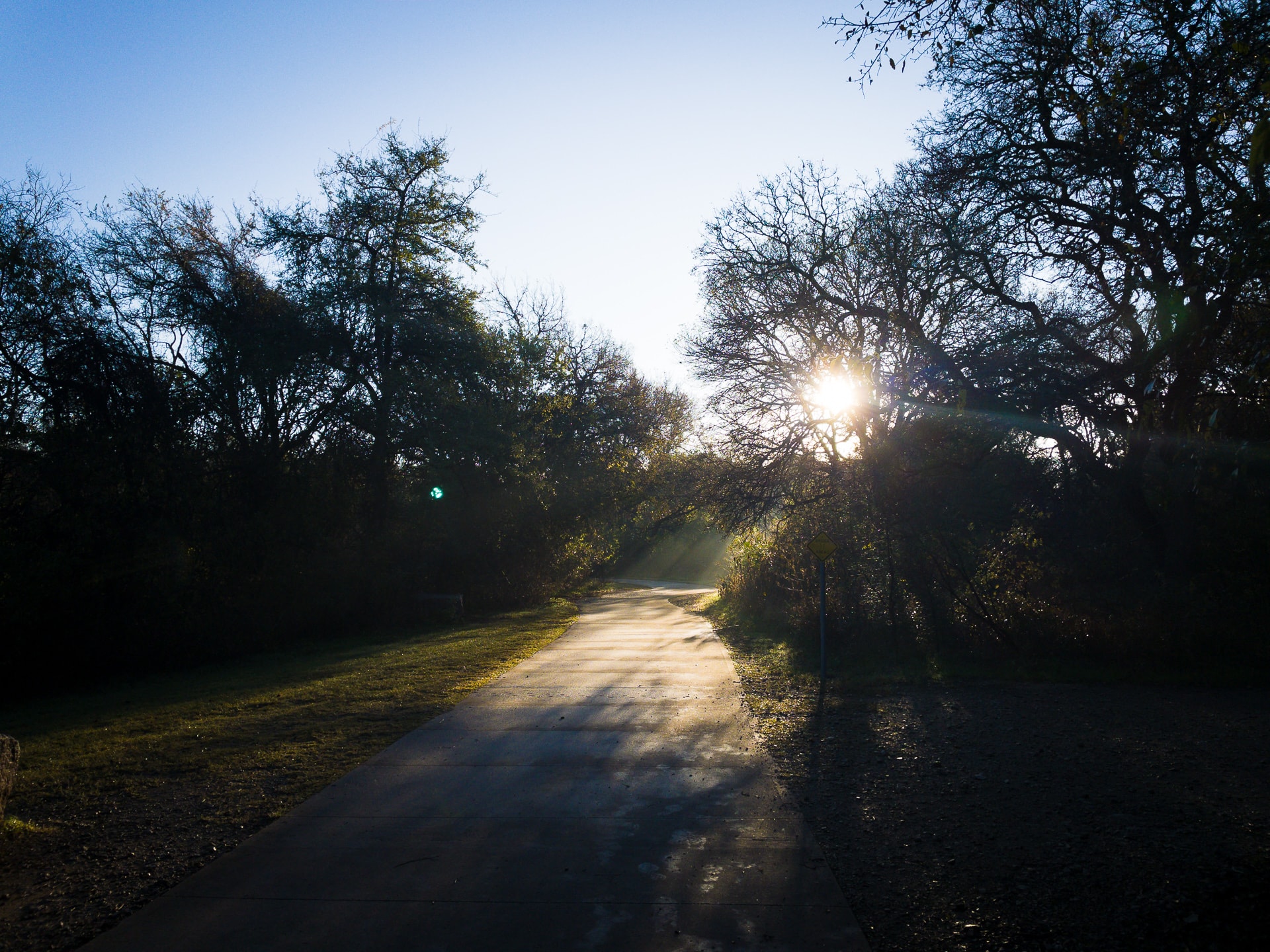
Today I went for a 7-mile run on the hike and bike path near my house. I really like the longer routes, especially towards the end when I am getting tired. I’ve noticed one change that happens to me when I get mentally fatigued on a run, and that’s that I get more emotional when listening to songs. Today, the songs that hit me were “Everybody Wants to Rule the World” by Tears for Fears, and “Alison” by Elvis Costello.
I can’t really place what specific emotions arise when I heard these… it was just a general feeling of being moved.
Maybe it’s kind of like a type of runner’s high? I don’t know, but I do know that I enjoy it when it happens.
Here’s one of my Spotify playlists that I often listen to while running.
Photo info: Apple iPhone 12 mini, 4.2mm, f/1.6, 1/200 sec, ISO32 “Under the Tracks” Cedar Park, 2021
The marathon training schedule I am following suggested a 7-mile “long run” this weekend, but I felt like I should up the mileage from last week’s distance so I went for a 14-mile run along Brushy Creek Regional Trail. I felt really good, especially because at about the halfway point (where I turn around and head home), there’s a water fountain and bathroom. What a huge difference that made!
Anyways, it was only 49° F when I started so I wore my Uniqlo leggings on and my old thrift-store Adidas pullover. With that combo, I am pretty comfortable running in the 50-60 degree range. Yay.
Regarding the training schedule, I think I will follow the schedule for rest days, but will use the recommended distances as a guideline. We’ll see how that goes. 😄
Photo info: Apple iPhone 12 mini, 4.2mm, f/1.6, 1/1700 sec, ISO32 “Sunrise” Cedar Park, 2021
If you are on Strava, let’s connect so that we can cheer each other on!
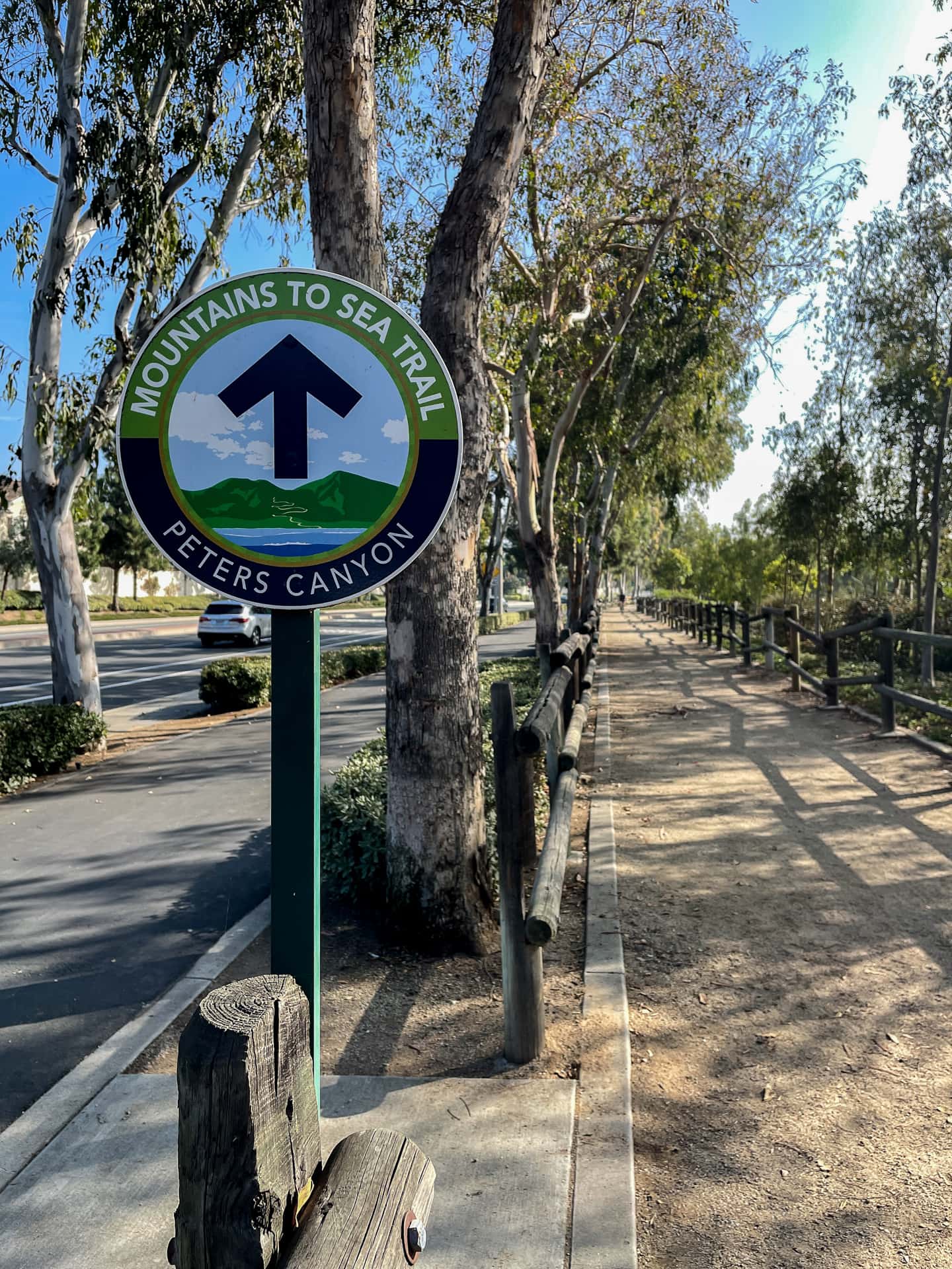
Photo info: Apple iPhone 12 mini, 4.2mm, f/1.6, 1/1600 sec, ISO32 “Mountains to Sea Trail” Orange, 2021
Today my marathon training schedule recommended a 10-mile run so I asked my brother and sister-in-law, who I am staying with for the weekend, to recommended a nice route. They told me I should run the “Mountains to Sea Trail”, which starts at a park near their house. As the name suggests, it goes all the way to the Pacific Ocean, but my plan was to turn around at 5 miles which would make the round-trip a nice 10 miles.
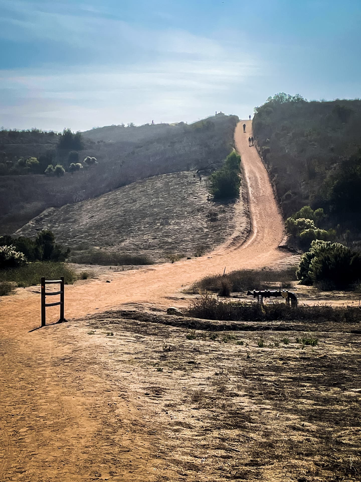
At the start of the run (going North to South), there’s a couple of trails to choose from in Peters Canyon Regional Park. The trail that goes up the ridgeline is more difficult, and the first hill is named “Big Red”. At first I was going to go for it, but then decided I should just take the easy trail since I was just starting a long run. But at the last second I thought that I should just go for the hill and see how it was. And it was tough! I ran up the first part of Big Red, but at the first viewpoint, I started walking and continued up to the first summit.
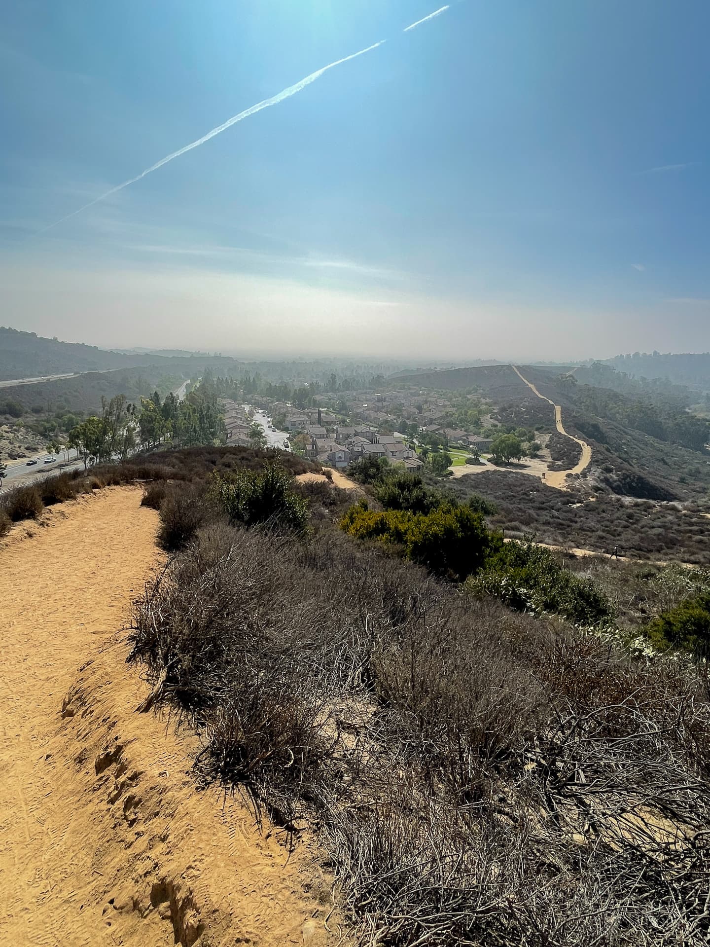
The view was awesome! Well worth the effort. The ridge trail goes back down before gaining elevation again, however, I decided to take the shortcut back down to the lower, easier trail, then continued my run.
The trail left the park boundaries and continued down Jamboree Boulevard, with a bike path and gravel path. It was really nice! At the 5.5 mile mark, I turned around and headed back, which pretty much all uphill. But the incline was very gentle and with only a couple nice hills, which I am enjoying more and more.
I had fun running the north section of the Mountains to Sea Trail and would definitely like to run or bicycle farther on it someday.
Like this:
LikeLoading...
My camera & photos
I use a Fujifilm X-series camera for most of the photos on this site and my Instagram. Why not pick one up for yourself?